DAY 1
Objectives
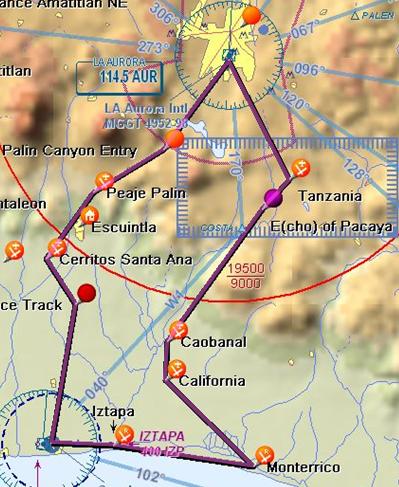
- Get to know the two most common routes to the Pacific starting from La Aurora (MGGT): via Palin and via E of Pacaya.
- Get to know and land at the following sites runways: Caobanal, Monterrico, Iztapa and San Jose.
- Identify Emergency landing sites along the way: California, Tanzania, Car Race Track “Escuintla”, Cerritos Santa Ana, Runway Peaje Palin and Model Plane Site in Guatemala.
Sequence (119 NM & estimated 2.5 hours with a several landings)
Leg 1: MGGT – Caobanal (via Tanzania & E de Pacaya)
- Identify Tanzania for possible emergency landings
Leg 2: Caobanal – Monterrico
- Identify California
Leg 3: Monterrico – Itzapa
Leg 4: Itzapa – San Jose
Leg 5: San Jose – MGGT (via Cerritos Santa Ana & Palin)
- Identify car race track
- Identify airport at Cerritos Santa Ana for possible emergency landings
- Identify airport at Paeje Palin-Escuintla for possible emergency landings
- Identify model plane area
Day 2
Objectives
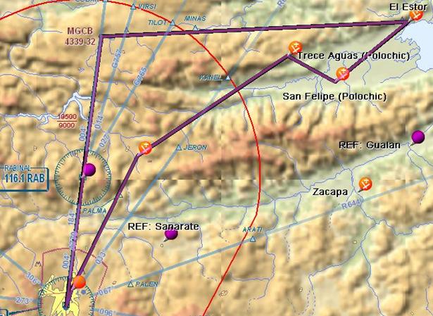
Sequence (156 NM, 2 hours)
Day 3
Objectives
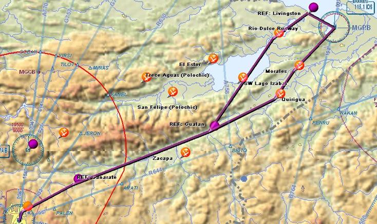
Sequence (212 NM. 2.5hours)
Day 4
Objectives
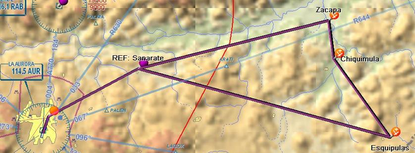
Sequence (279 NM, 3 hours)
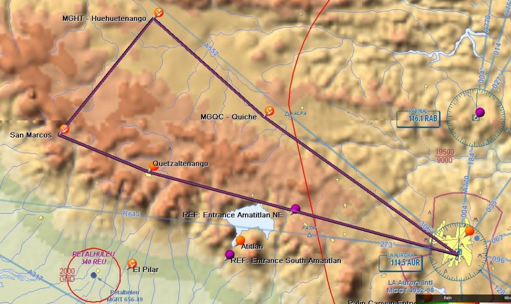
Day 5
Objectives
Sequence (167 NM, 2 hours)
DAY 5 – Mountain Route
Objectives
- Get to know the western highlands
- Identify and land on the highest airports in Guatemala: Quetzaltenango, San Marcos, Huehuetenango & Quiche
- Get to know San Marcos, the runway is situated just under 8000 ft and is a slight uphill in good conditions.
- Quiche is a gravel runway in not so good conditions.

