 Flight Briefing from La Aurora, Guatemala (MGGT) to Costa Esmeralda airport, Nicaragua (MNCE).
This route is from Guatemala to San Salvador airport, and then stays close to the coastline via A317. IFR makes it easy with airspaces and traffic.
Route
IFR MGGT AUR (G436) KAPAN (G436) CAT (A317) TUKOR (Direct) COSEM
11,000 ft or higher
Distance 332 NM
Flight Sequence Briefing
MGGT
- ATIS 127.65
- Clearance 120.70
- Expect PALEN departure with KAPAN transition
- Ground 121.90
- Request taxi to “Rampa Internacional Sur”
- Tower 118.10
- VOR 1 AUR 114.90 R-012
- VOR 2 RAB 116.10 R-155 (required for PALEN departure)

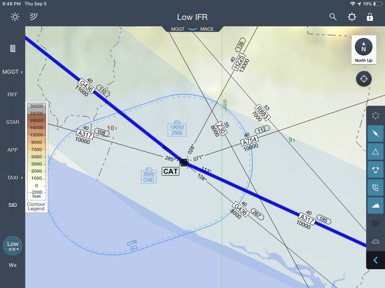
MGGT departure
- Expect COM change to La Aurora Control 119.30 after takeoff
- PALEN departure KAPAN transition
- Climb on AUR R-012 until reaching 7000′ or above. Turn right to intercept RAB R-155.
- [KAPAN] Continue climbing on RAB R-155 to intercept G-436 at or above 11000′, according to ATC instructions.
- VOR 1 AUR 114.90 R-126
- VOR 2 CAT 117.50 R-127
- Expect ATC instructions direct to KAPAN at or above 7000′

KAPAN
- KAPAN marks the border between Guatemala and El Salvador
- Expect COM hand-over from Guatemala Control to San Salvador Control COM 119.90 and new altimeter setting
- VOR 1 CAT 117.50 R-127
- VOR 2 AUR 114.90 R-126

CAT
- VOR 1 CAT 117.50 R-113
- MEA reduced from 11000′ to 10000′
- Busy airspace, watch our for traffic flying in and out San Salvador

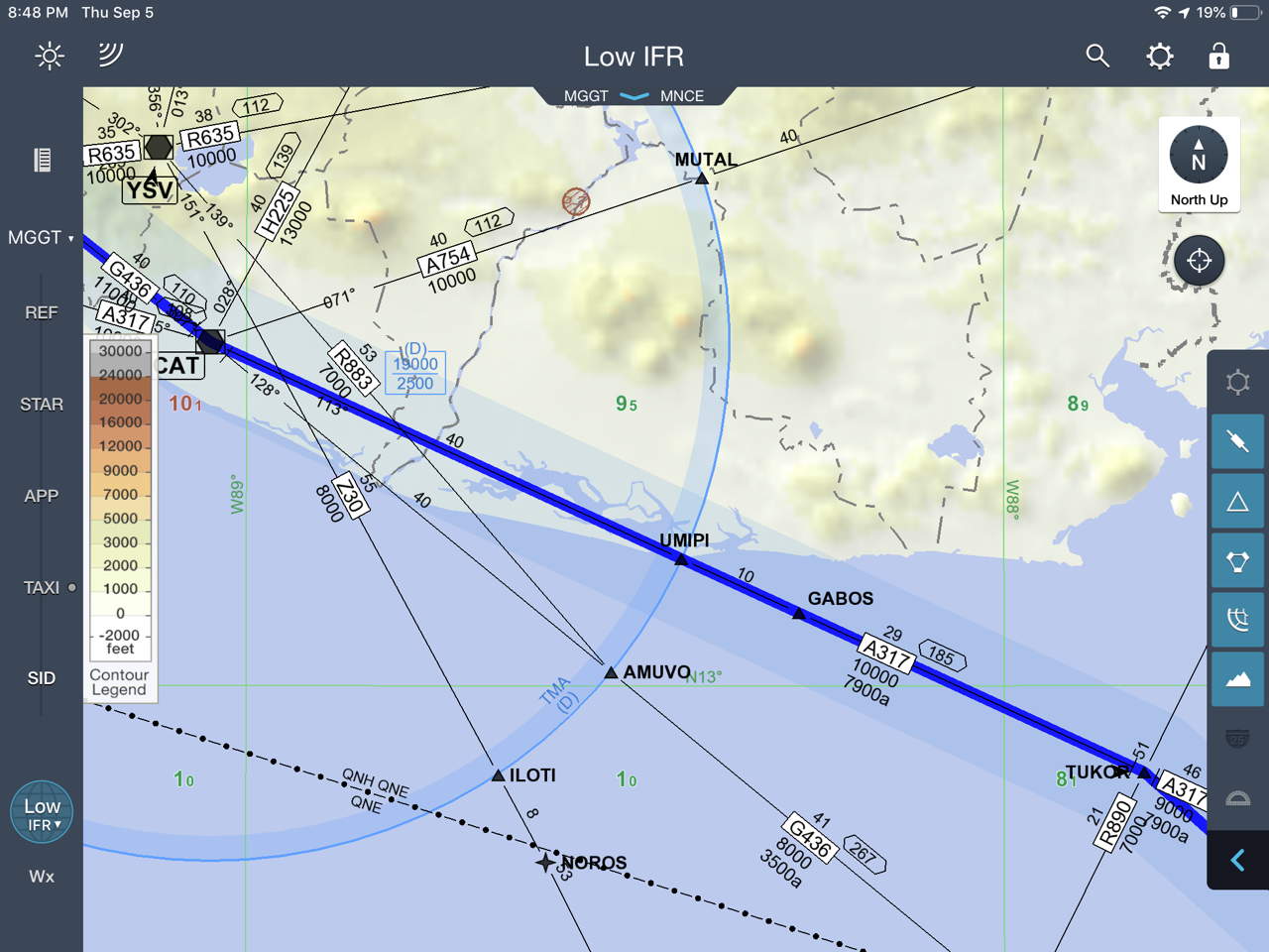
GABOS
- Expect COM radio gap between San Salvador and Sandinos. Ask for Sandino frequency in advance.
TUKOR
- Max distance from shore less than 14 NM at any time
- TUKOR marks the border between El Salvador and Nicaragua
- Expect COM radio hand-off from San Salvador control to Sandino Approach COM 119.40 and new altimeter setting
- Expect ATC instructions direct to COSEM N 11 21.5 W 086 04.9 or direct to MNCE
- MEA on A317 reduced to 9000′
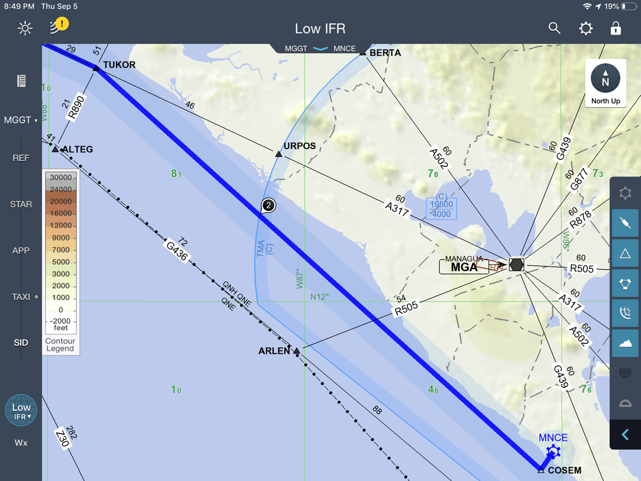
TUKOR-COSEM
- Expect descent instructions
- Expect to be asked if “airport is in sight”
- Checkpoint R505 intersection VOR NAV 2 MGA 112.10 R-249
- Expect COM hand-off from Sandino approach to Costa Esmeralda Tower COM 118.05
- Request visual approach with airport in sight
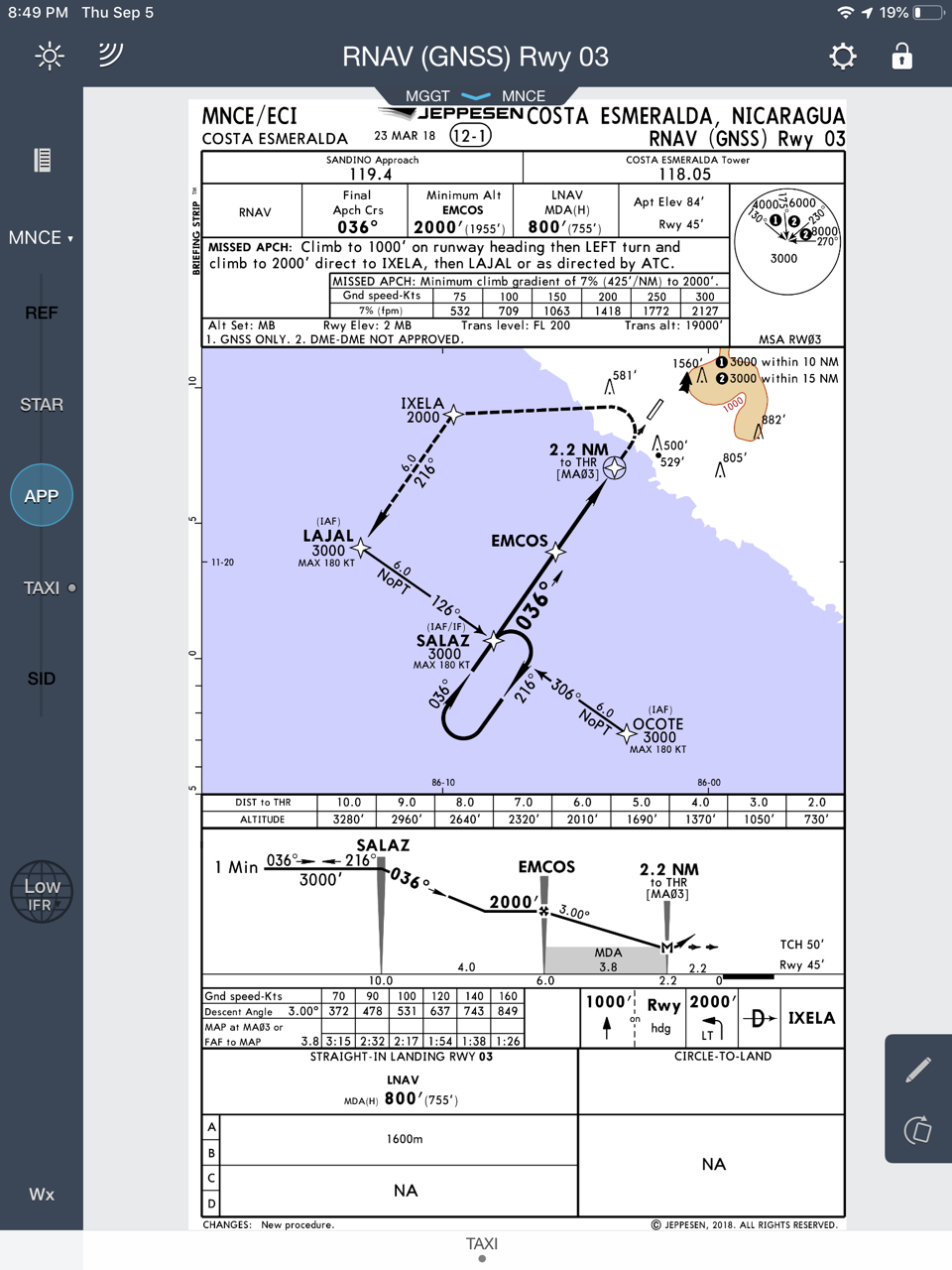
- GPS approach RNAV (GNSS) Rwy 03 for reference
- IAF Salaz (10NM) 3000′
- 036° to EMCOS (6NM) descent to 2000′
- 036° Continue descent to MDA 800′
- MA03 (2.2NM) 800 execute missed approach.
- Missed approach: Climb to 1000′ on runway heading then LEFT turn and climbr to 2000′ direct to IXELA then LAJAL or as directed by ATC
MNCE
- Taxi diagram
- Costa Esmeralda Airport
